
Harrisonburg, VA
Real estate media
built for Harrisonburg agents.
Professional photography, drone, 3D virtual tours, twilight photos, and floor plans for listings in Harrisonburg, Bridgewater, Dayton, Massanutten, and Rockingham County. Disabled veteran owned. 24-hour turnaround.
Serving Harrisonburg, VA
Why Harrisonburg agents
choose Villa Views.
The Harrisonburg market covers more ground than almost any in the Valley, and its four corners want different things from a photo set. In-town neighborhoods and JMU-area rental property trade on condition, layout, and what each bedroom actually is. Working farms and acreage across Rockingham County are bought for the land, the outbuildings, and the lot lines as much as the house. Raw land and lot listings have no house to photograph at all. And the Massanutten area runs on short-term rental turnover, where the photos are a storefront that keeps earning rather than marketing that comes down at closing. Villa Views covers all of it from Waynesboro, with FAA-certified drone work for the rural half of that list and a flat, transparent travel fee, typically about $25, confirmed before you ever go on the calendar.
Real Estate Photography
Sharp, bright listing photos sized for MLS. 24-hour turnaround, same-day available.
Aerial Drone Photography
Farms, acreage, and lot lines - aerials built for how Rockingham County properties actually sell.
Twilight Photography
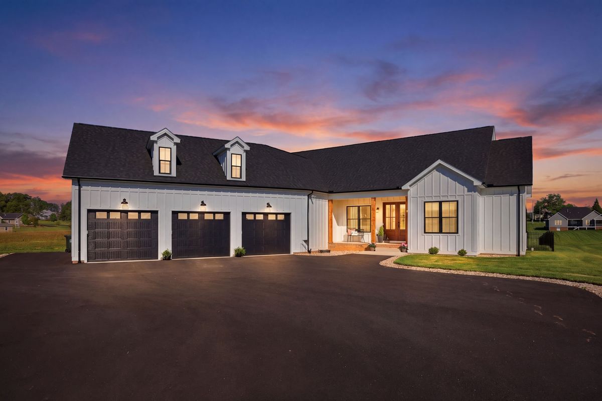
Evening exteriors that stand out in the Harrisonburg listing feed.
3D Virtual Tours
Let out-of-market buyers and investors walk through before they visit.
Airbnb & VRBO Licensing
Massanutten rental? A flat $200 license covers unrestricted ongoing use of your photos.
Pay at Close
Book the full package. Pay $0 upfront. Repay from your commission at closing.
Learn more →Shooting this market
Four Rockingham County listings,
four different jobs.
Harrisonburg is not one market, it is four sitting on top of each other. A student rental off Port Republic Road and a hundred-acre farm outside Broadway are not the same assignment, and shooting them the same way shortchanges both.
Farms and acreage across Rockingham County
On a working property the house is one asset among several. Buyers want to see how the outbuildings sit relative to it, where the fence line runs, how much of the acreage is pasture versus wood, and what the mountain backdrop actually looks like from the property rather than from the road. Aerials answer all of that in one frame. Ground-level photography cannot, no matter how wide the lens.
JMU-area rental and investment property
An investor is underwriting, not falling in love. They want condition, unit count, and what each bedroom honestly is, and they can spot a room shot from the doorway with a wide lens to make it look bigger. Straight, accurate, well-lit photography plus a floor plan does more for that buyer than anything stylized, because the floor plan settles the bedroom-count question before the showing.
Short-term rentals around Massanutten
A rental listing is a storefront, not a sale. The photos stay up and keep earning every booking cycle instead of coming down at closing, which changes both the shot list and the licensing. Amenity-forward frames, the deck, the hot tub, the bunk room, the view, and a flat $200 commercial license per property that covers that ongoing use once, with no renewals and no cut of your bookings.
Land and lot listings with no house on them
Raw land is the listing most often marketed with a plat map and one photo from the shoulder of the road. The parcel is the entire product, so it deserves to be shown as one: aerials that establish shape and boundaries, elevation and how the ground actually lies, road frontage, tree cover, and what a buyer would see standing where a house would go.
Two things worth knowing
How I price
and how you pay.
Pay at Close: $0 upfront
Marketing a listing means fronting money on a sale that has not happened yet, which is why so many listings get shot to the budget instead of to the property. Pay at Close removes that tradeoff. Book the full package, photography, drone, twilight, 3D tour, whatever the property actually needs, and pay nothing on the day.
Financing runs through Titus. Approval comes back in about two minutes on a soft credit check, with no hard pull and no impact on your score regardless of the outcome. You repay from your commission when the listing closes, or within 6 months, whichever comes first.
It matters most on exactly the listings Rockingham County is full of: the farm where the aerials are not optional, the land parcel that needs drone to make any sense at all.
A travel fee you can calculate yourself
Harrisonburg sits just outside the no-travel-fee core zone, so rather than pretend otherwise: it is a flat $1 per mile from Waynesboro, which works out to about $25 on most Harrisonburg listings. Bridgewater and Weyers Cave are inside the core zone and carry no fee at all.
The point is not that it is small, though it is. The point is that it is a published rule you can run yourself before you book, not a number that appears on the invoice after the shoot. No drive-time surcharge on the rural listing, no rounding up because the property was hard to find.
You see it and confirm it when you book. It does not change afterward.
Harrisonburg Service Area
Where I work in and around Harrisonburg.
Villa Views covers Harrisonburg city, Bridgewater, Dayton, Weyers Cave, Grottoes, Massanutten, Elkton, Broadway, and the broader Rockingham County market. I am based in Waynesboro, about 30 minutes south on I-81, and every service on the menu is available on Harrisonburg listings.
Harrisonburg listings carry a flat $1-per-mile travel fee from Waynesboro - typically around $25 - shown and confirmed when you book, never added after the fact. Bridgewater and Weyers Cave fall inside the no-fee core zone.
Common questions
Harrisonburg listings, answered.
Harrisonburg sits just outside my no-fee core zone, so a flat $1-per-mile travel fee from Waynesboro applies, typically around $25 for most Harrisonburg listings. It is calculated the same way for everyone, shown and confirmed when you book, and never added to the invoice afterward. Bridgewater and Weyers Cave fall inside the no-fee core zone.
Photography starts at $195 per listing. Drone aerials are $95 as an add-on to a photo shoot or $150 standalone. Drone video runs from $125 for an aerial clip or $165 for a walkthrough plus aerial. 3D virtual tours start at $200 per property, floor plans start at $125 for 2D and $185 for 3D, virtual staging is $35 per image, and twilight is $30 for a virtual conversion or $180 for a real twilight shoot. Add the flat travel fee, typically about $25 to Harrisonburg. Every service is eligible for Pay at Close, which means $0 upfront.
Yes, and Rockingham County acreage is exactly where FAA-certified drone photography earns its keep. Ground-level photos cannot show lot lines, how the outbuildings sit relative to the house, where the pasture ends, or the mountain backdrop behind the tree line. Aerials establish the parcel and drone video walks the approach the way a buyer drives in. This applies to raw land and lot listings too, where there is no house to photograph and the parcel itself is the entire product.
Yes. Short-term rentals are a different assignment from a for-sale listing, because the photos are the storefront and they keep working every booking cycle rather than coming down at closing. For Airbnb, VRBO, and Massanutten-area rentals, commercial use is a flat $200 per property, one time, for unrestricted continued use. No renewals, no percentage of booking revenue, and no expiration, against a market norm of two to three times the shoot fee for the same rights. Details on the licensing page.
Yes. Investment property is a large part of the Harrisonburg market, particularly the JMU-area rental stock, and the media brief is different from an owner-occupied sale. Investors are underwriting condition, unit count, and what each bedroom actually is, not falling in love with a kitchen. Clean, accurate, well-lit photography plus a floor plan usually does more for that buyer than anything stylized. For owners marketing a unit for rent rather than for sale, the flat $200 commercial license covers ongoing use.
Yes. 3D virtual tours give an out-of-market buyer or investor a full room-by-room walkthrough from any device, with an embeddable link for your MLS listing. On rural Rockingham County listings this pairs well with drone, since the tour answers what the inside is like and the aerials answer what the land is like, which are the two things a buyer cannot judge from a map.
24-hour delivery is standard on every shoot, with same-day available at checkout. Files arrive edited, MLS-sized, and ready to upload, so a Tuesday afternoon shoot is on the MLS Wednesday morning. Booking is online, so scheduling a Harrisonburg listing does not wait on a phone call being returned.