
Drone Photography - Lexington, VA
Drone Photography
in Lexington, VA.
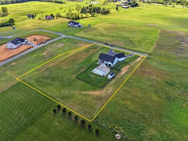
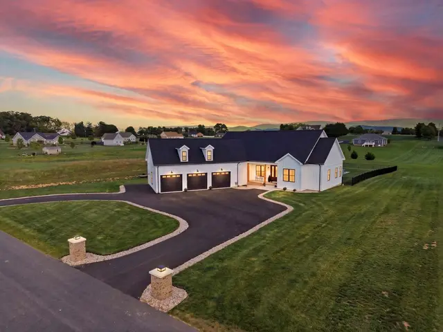
Rockbridge County listings are rarely just a house. They are acreage, fence lines, river frontage, and a ridge line behind it all. FAA-certified aerials show buyers the part of the property that ground photos physically cannot reach.
Why aerials matter here
On acreage, the listing photos
stop at the tree line.
A twelve-acre parcel outside Lexington and a half-acre lot in town can look nearly identical from the driveway. That is the whole problem. When the land is the value, ground-level photos quietly under-sell it, and buyers scrolling Zillow have no way to tell the difference.
An aerial set fixes that in about four frames. Lot shape and where the parcel actually ends. Fence lines, pasture, and outbuildings in relation to the house. Road frontage and access. And the Blue Ridge sitting behind the whole thing, which is frequently the reason someone buys in Rockbridge County in the first place.
Maury River frontage is the clearest example. It is often the most valuable feature on the sheet and the hardest thing to photograph from the bank. From 200 feet it reads instantly.
Out-of-area buyers
Half your buyers are
looking from somewhere else.
Lexington draws relocation buyers, second-home buyers, and Washington and Lee and VMI families who are shopping from out of state and will visit once, maybe twice, before deciding.
Those buyers cannot drive the neighborhood on a Saturday. An aerial does that job for them: where the property sits relative to town, how far the nearest neighbor is, whether the road is paved, what the approach looks like. It answers the questions that otherwise turn into a phone call, or into no call at all.
Lexington, VA
Serving Lexington and
Rockbridge County.
Villa Views covers Lexington, Buena Vista, Natural Bridge, and the wider Rockbridge County market. I am based in Waynesboro. Lexington sits in my extended zone, so a flat $1-per-mile travel fee applies, typically around $35, confirmed before you book.
Drone photography is $95 as an add-on / $150 standalone. 24-hour delivery standard. MLS-ready files every time. All flights under FAA Part 107. Pay at Close available with $0 upfront through Titus.
Common questions
Questions I get
about this.
Lexington sits in my extended zone, so a flat $1-per-mile travel fee from Waynesboro applies - typically around $35 for Lexington, Buena Vista, and Natural Bridge listings. I confirm the exact figure before anything goes on the calendar.
Drone photography is $95 as an add-on to a photo shoot, or $150 standalone, plus the flat travel fee. Files are delivered MLS-ready within 24 hours.
It is usually the single most useful thing you can add. On acreage, ground photos cannot show where the property actually ends. Aerials establish lot shape, fence lines, outbuildings, road frontage, and how the parcel sits against the ridge line.
Yes. All flights are flown under FAA Part 107 certification and within current airspace rules for the Lexington and Rockbridge County area.